


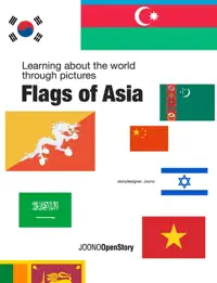
Exploring the World Through Atlases & Maps
Atlases and maps have long been essential tools for adventurers, researchers, and curious minds looking to explore the world around them. From ancient times to the modern era, these visual representations of our planet have provided invaluable information and insights about different cultures, landscapes, and historical events. In today's digital age, the use of atlases and maps has evolved, but their importance remains unchanged.
The History of Atlases & Maps
Maps have been used by humans for thousands of years to navigate their surroundings, plan journeys, and record important information. The earliest known maps date back to ancient civilizations such as the Babylonians, Egyptians, and Greeks, who created simple, hand-drawn maps to represent their territories and trade routes.
Over time, the art of cartography evolved, and more detailed and accurate maps were produced. The invention of the printing press in the 15th century revolutionized mapmaking, making it easier to distribute maps to a wider audience. The first modern atlas, a collection of maps bound together in a book, was published in the 16th century by Flemish cartographer Abraham Ortelius.
The Importance of Atlases & Maps Today
While digital mapping technologies such as GPS and satellite imagery have made it easier to navigate and explore the world, atlases and maps continue to play a vital role in education, research, and travel. Atlases provide a comprehensive overview of a region or topic, with detailed maps, illustrations, and textual information that enhance the reader's understanding.
Maps are not just tools for finding directions; they also serve as visual representations of data and trends. Geographical information systems (GIS) use maps to analyze and interpret spatial data, helping researchers, urban planners, and policymakers make informed decisions about land use, resource management, and infrastructure development.
Exploring the Diversity of Atlases & Maps
The world of atlases and maps is incredibly diverse, with publications covering a wide range of topics and formats. Historical atlases trace the evolution of civilizations and empires, while thematic atlases focus on specific subjects such as climate, wildlife, or population demographics.
- Physical atlases showcase the natural features of the Earth, including mountains, rivers, and ecosystems.
- Political atlases provide detailed maps of countries, regions, and cities, showing borders, capitals, and other administrative divisions.
- Road atlases are essential tools for travelers, offering detailed maps of highways, roads, and points of interest.
Maps can also be works of art, with cartographers using creative techniques and designs to convey information in visually engaging ways. Antique maps, with their intricate illustrations and decorative borders, are highly sought after by collectors and enthusiasts.
Discovering New Perspectives with Atlases & Maps
Whether you are a student studying geography, a hiker planning a wilderness adventure, or a history buff exploring the past, atlases and maps offer a unique window into the world. By delving into the pages of an atlas or unfolding a detailed map, you can uncover hidden treasures, connect with distant cultures, and gain a deeper appreciation for the diversity of our planet.
At our online bookstore, we offer a curated selection of atlases and maps to suit every interest and curiosity. From beautifully illustrated world atlases to practical street maps, we invite you to embark on a journey of discovery and exploration through the pages of a book.